Today, September 2026
July 9, 2026
Brookshire’s breaks ground on a $17 million, roughly 58,467-square-foot store at 3765 Earl Campbell Parkway in west Tyler, with a full-service Stanley’s. It is expected to be complete by fall 2027.
Pull the ruler and watch the town fill in, from twenty-eight blocks in 1847 to today, over the fire insurance maps and surveys of each era.Twenty-eight blocks around a square in 1847, and the town of today. Every stop between them is below, in order.
July 9, 2026
Brookshire’s breaks ground on a $17 million, roughly 58,467-square-foot store at 3765 Earl Campbell Parkway in west Tyler, with a full-service Stanley’s. It is expected to be complete by fall 2027.

The live map could not load. This drawing is the same map, and every place is listed on the places page.
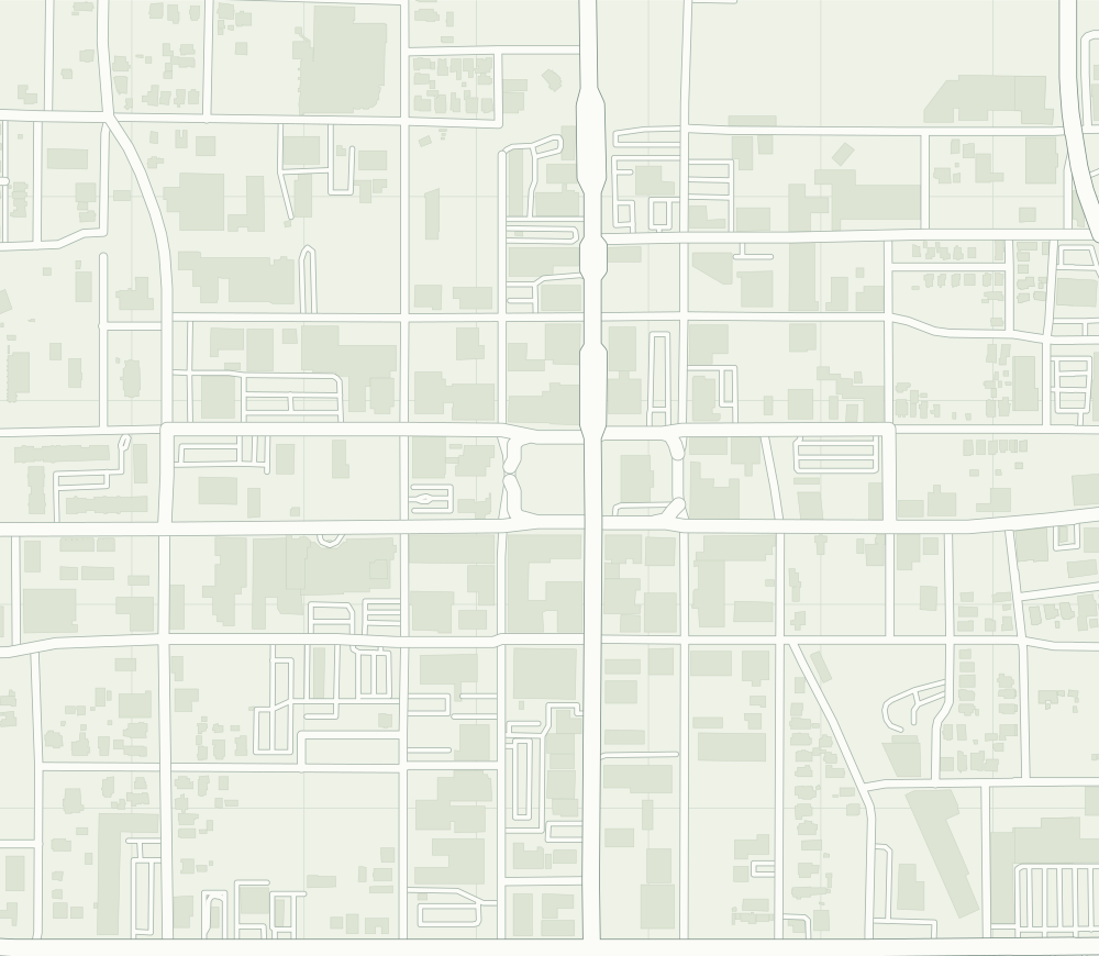
Under the plate: today’s streets, © OpenStreetMap contributors.
Under the plate: Sanborn map, May 1885. Sanborn Map Company, Tyler, Smith County, Texas, 1885. Library of Congress, Geography and Map Division, Sanborn Maps Collection.
Under the plate: Sanborn map, November 1889. Sanborn Map Company, Tyler, Smith County, Texas, 1889. Library of Congress, Geography and Map Division, Sanborn Maps Collection.
Under the plate: Sanborn map, January 1893. Sanborn Map Company, Tyler, Smith County, Texas, 1893. Library of Congress, Geography and Map Division, Sanborn Maps Collection.
Under the plate: Sanborn map, September 1898. Sanborn Map Company, Tyler, Smith County, Texas, 1898. Library of Congress, Geography and Map Division, Sanborn Maps Collection.
Under the plate: Sanborn map, November 1902. Sanborn Map Company, Tyler, Smith County, Texas, 1902. Library of Congress, Geography and Map Division, Sanborn Maps Collection.
Under the plate: Sanborn map, September 1907. Sanborn Map Company, Tyler, Smith County, Texas, 1907. Library of Congress, Geography and Map Division, Sanborn Maps Collection.
Under the plate: Sanborn map, February 1912. Sanborn Map Company, Tyler, Smith County, Texas, 1912. Library of Congress, Geography and Map Division, Sanborn Maps Collection.
Under the plate: Sanborn map, August 1919. Sanborn Map Company, Tyler, Smith County, Texas, 1919. Library of Congress, Geography and Map Division, Sanborn Maps Collection.
Under the plate: Sanborn map, March 1928. Sanborn Map Company, Tyler, Smith County, Texas, 1928. Library of Congress, Geography and Map Division, Sanborn Maps Collection.
Under the plate: Sanborn map, 1938. Sanborn Map Company, Tyler, Smith County, Texas, 1938. Library of Congress, Geography and Map Division, Sanborn Maps Collection.
Under the plate: USGS map, 1948. U.S. Geological Survey 1:62,500-scale Quadrangle for Tyler, TX 1948 courtesy of the U.S. Geological Survey.
Drag the ruler, or use the arrow keys: one year at a time, ten with Page Up and Page Down.Swipe the ruler.
April 11, 1846
Tyler is authorized. The Texas Legislature creates Smith County and its county seat, and the town is named for President John Tyler, for his support of admitting Texas to the Union.
Handbook of Texas; National Register of Historic Places nomination
February 6, 1847
Commissioners buy a 100-acre site from Edgar Pollett (the downtown nomination spells it Pollitt) for $150 and lay out the town in 28 blocks around a central square.
1847
The townsite has five north-south avenues (Bois D’Arc, College, Broadway, Fannin and Spring) and four east-west streets (Locust, Ferguson, Erwin and Elm); College, Fannin, Ferguson and Erwin got those names later.
1847
The founders name the north-south roads avenues and the east-west roads streets. Downtown, the avenues measure 50 feet wide and the streets 35 feet.
1846 to 1848
Smith County’s own history says its first courthouse was a log cabin on West Erwin Street in 1846, followed by a log courthouse on East Ferguson in 1847 and a 520-square-foot log courthouse on the square in 1848. The Handbook of Texas puts the first one on the north side of the square, and another in its center in 1847.
Smith County; Handbook of Texas; National Register nomination
From 1848
Marvin Methodist’s congregation, which the downtown nomination calls the first of any denomination organized in Smith County, meets in the log cabins on the courthouse square. The Handbook says a Methodist church was organized in 1846.
1849
John Lollar sells land and reserves five acres for burials: Oakwood Cemetery, on North Palace Avenue at West Oakwood Street, which the Tyler MPS calls the town’s oldest. The first burials there are thought to date to 1846; the oldest marked grave is from 1852.
1852
The county builds its first brick courthouse in the middle of the square, two stories and 40 by 60 feet. The old log courthouse is moved and used as the jail.
Smith County; Handbook of Texas; National Register nomination
1855 to 1858
Alfred W. Ferguson builds five brick stores on the northwest side of the square, and Col. George Yarbrough a three-story dry-goods building on the northeast side.
1859
Samuel Gallatin Smith builds the Goodman-LeGrand House at 624 N. Broadway as 'Bonnie Castle'.
Tyler Morning Telegraph, September 6, 2025; Tyler Morning Telegraph, March 20, 2026
1880
The house gains a second story.
Tyler Morning Telegraph, September 6, 2025; Tyler Morning Telegraph, March 20, 2026
1926
A remodel gives it circular porticos and two-story columns.
Tyler Morning Telegraph, September 6, 2025; Tyler Morning Telegraph, March 20, 2026
1939–1940
Sallie Goodman-LeGrand dies in 1939, and the City of Tyler takes ownership in 1940.
Tyler Morning Telegraph, September 6, 2025; Tyler Morning Telegraph, March 20, 2026
September 2025
The house is open Tuesday through Saturday, 10 a.m. to 4 p.m., with free admission and a suggested $3 donation, and the Azalea Trail starts there. Check before you go: these are the hours as of September 2025.
Tyler Morning Telegraph, September 6, 2025; Tyler Morning Telegraph, March 20, 2026
1862
Gunsmiths J.C. Short and William S.N. Biscoe, with Col. George Yarbrough, found an ordnance plant in a two-story brick building on a 125-acre site, to make 5,000 rifles for Texas. It is sold to the Confederate government in October 1863.
During the war
The Handbook of Texas calls it the largest Confederate ordnance plant in Texas; a 1965 state marker on the courthouse grounds calls it the largest west of the Mississippi.
Handbook of Texas: Tyler, TX; Handbook of Texas: Camp Ford; National Register of Historic Places nomination; 1 more
July 21, 1863
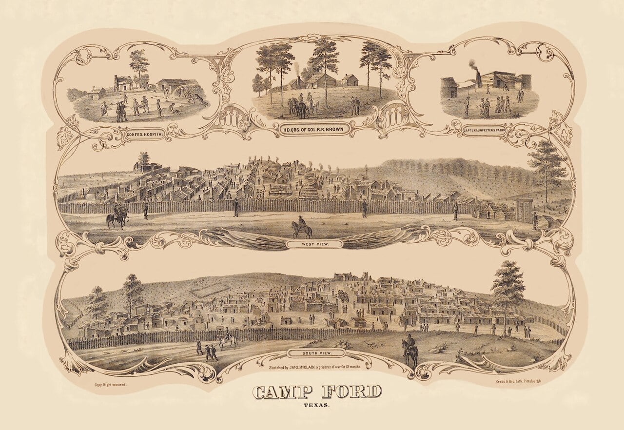
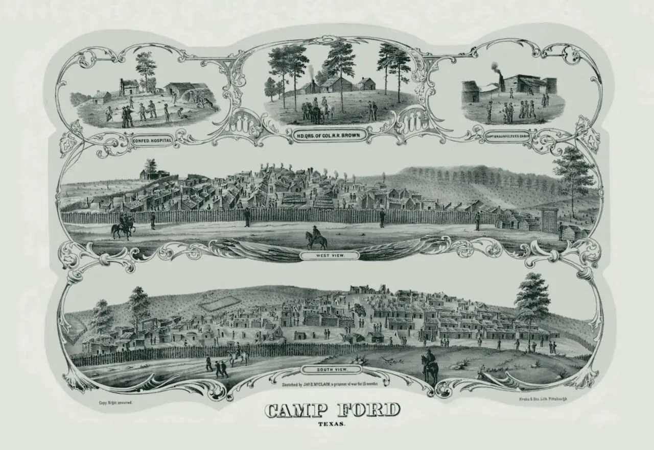
Camp Ford, a conscript-training camp four miles northeast of Tyler since 1862, named for Col. John S. (Rip) Ford, is ordered made a prison camp. It was the largest Confederate prison camp west of the Mississippi.
Handbook of Texas: Camp Ford (F. Lee Lawrence); Handbook of Texas: Tyler, TX; National Register of Historic Places nomination
After mid-1863
Tyler is the transportation headquarters of the Confederacy’s Trans-Mississippi Department, according to the 1968 City of Tyler marker on the courthouse lawn.
1864
The stockade, built in November 1863 beside a spring, is doubled in size after about 3,000 prisoners arrive in April 1864; it holds 4,725 men that spring.
1864
Under Lt. Col. G.H. Hill the ordnance plant has 150 to 200 workers; in three months of 1864 it makes 394,156 cartridges, 411 rifles and 3,531 canteens.
May 17, 1865
About 6,000 prisoners were held at Camp Ford over two years, and 286 died there. The last 1,200 leave for Shreveport; that July a Union cavalry detail destroys the compound.
1936 and 1969
A 1969 marker near the ordnance plant’s site stands in Bergfeld Park at South College and Fourth Street. A 1936 Texas Centennial marker titled ‘Confederate Arms Factory’ stands at Mockingbird Lane and Robertson Street.
THC Atlas, historical marker 7763; THC Atlas, historical marker 7714
Today
The stockade’s site is Camp Ford Historic Park, owned by Smith County and managed by the Smith County Historical Society, on US Highway 271 about 0.8 miles outside Loop 323. It is free, dawn to dusk.
December 1, 1871
The Tyler Tap Railroad is chartered by a special act of the legislature, after 23 Tyler citizens led by Richard B. Hubbard and Maj. James P. Douglas apply. It may build up to 40 miles, to a connection with another railroad.
1872
The International and Great Northern (then the Houston and Great Northern) bypasses Tyler, routing its main line through Troup, 19 miles southeast.
National Register Multiple Property Documentation Form; Handbook of Texas: Tyler, TX (Christopher Long); Handbook of Texas: Tyler Tap Railroad (Vista K. McCroskey)
1873 or 1874
After lobbying, Tyler gets a branch from Troup. When it reached the town, the sources disagree: April 1873, by the Tyler MPS and the Handbook’s Tyler Tap entry; April 1874, by the Handbook’s Tyler entry; 1874, by the downtown nomination.
National Register Multiple Property Documentation Form; Handbook of Texas: Tyler, TX (Christopher Long); Handbook of Texas: Tyler Tap Railroad (Vista K. McCroskey); 1 more
October 1, 1877
The Tyler Tap’s only locomotive, the Governor Hubbard, brings the line’s first train into Tyler over 21 miles of three-foot-gauge track from Big Sandy (then Ferguson). The locally backed line grows into the Cotton Belt.
Handbook of Texas: Tyler Tap Railroad (Vista K. McCroskey); Handbook of Texas: Tyler, TX; National Register of Historic Places nomination; 1 more
May 14, 1879
By charter amendment the Tyler Tap becomes the Texas and St. Louis Railway, the beginning of the Cotton Belt. (The Tyler MPS says it was reorganized in the fall of 1878.)
1880s
The Cotton Belt lays its tracks in an arc across the north edge of downtown; the International and Great Northern runs north-south along its eastern edge.
1880–1890
An influx of railroad-shop workers nearly triples Tyler’s population between 1880 and 1890, the Handbook of Texas says. The census counts 2,423 people in 1880 and 6,908 in 1890.
1888
The Cotton Belt completes its first hospital for railroad workers at West Elm Street and its tracks; its wooden shops northeast of the square employ about 100 to 150 men.
1898
The Cotton Belt begins burning crude oil in its locomotives, which the Tyler MPS calls the first railroad in the Southwest to use oil as fuel. New shops go up on the site of the wooden ones.
1904
When the Cotton Belt announces it will move its headquarters and shops to Texarkana, the City of Tyler sues. The railroad loses and keeps its headquarters in Tyler.
September 1880 to April 1881
The Smith County Jail goes up on East Erwin Street just east of the square: the county’s third jail, in use until 1916.
National Register nomination; THC Atlas, National Register listing
1897 and 1898
According to the jail’s National Register nomination, a mob lynches an African American man held there in 1897, and in 1898 another mob shoots an Anglo American man to death in his cell.
National Register nomination; THC Atlas, National Register listing
May 1, 1909
A mob breaks into the jail with sledgehammers, seizes Jim Hodge (the downtown nomination also spells it Hodges), held on a rape charge, and lynches him on the courthouse square. Later statements by his accuser led many to believe he was innocent.
National Register Multiple Property Documentation Form; National Register nomination
March 9, 1916
The county sells the jail to Jefferson Y. Lewis for $1,800, and he makes it the Lewis Hotel.
National Register nomination; THC Atlas, National Register listing
1986 and 1996
Historic Tyler, Inc., buys the building in 1986; it is listed on the National Register on August 22, 1996.
National Register nomination; THC Atlas, National Register listing
1888 to 1891
St. James C.M.E. Church goes up at 408 North Border Avenue as a wooden Gothic Revival church. Its cornerstones read 1888 and 1889; its 2004 National Register nomination says it was likely built between 1889 and 1891, under the Rev. I. S. Persons.
National Register Multiple Property Documentation Form; THC Atlas, National Register listing; National Register nomination
1894
With help from St. James C.M.E., ministers of the Colored Methodist Episcopal Church found Texas College, north of the city limits.
1920s
The church is bricked: about 1920, by its nomination; between 1921 and 1929, by the Tyler MPS.
National Register Multiple Property Documentation Form; THC Atlas, National Register listing; National Register nomination
2001 and 2004
The Tyler MPS calls it the only known surviving 19th-century African American church building in Tyler, and its nomination the oldest surviving African American church in Tyler. It is listed on the National Register on August 20, 2004.
National Register Multiple Property Documentation Form; THC Atlas, National Register listing; National Register nomination
1882
Tyler’s first Immaculate Conception church is built at the northwest corner of North College Avenue and West Locust Street; many early parishioners are Irish railroad workers.
National Register Multiple Property Documentation Form; Diocese of Tyler
April 11, 1887
Congregation Beth El is founded and first meets in the Odd Fellows hall on the square; it dedicates its first temple at South College Avenue and University Place in 1889.
1890
Marvin Methodist Episcopal Church, South, builds a brick church for $60,000 at the southwest corner of West Erwin Street and South Bois D’Arc Avenue.
National Register nomination; THC Atlas, National Register listing
1891
Bethlehem First Baptist, Tyler’s first Black Baptist congregation, builds a church on West Front Street that the Tyler MPS, citing the City of Tyler, calls the first brick church in Texas built by African Americans. It moves to West Lollar Street in 1933.
1913 and 1918
First Baptist builds at the northwest corner of West Ferguson Street and North Bois D’Arc Avenue in 1913, and Christ Episcopal finishes its Gothic Revival church on South Bois D’Arc in 1918.
March 17, 1935
The present Immaculate Conception church, at South Broadway and West Front Street, is dedicated (the Tyler MPS says it was built in 1934).
National Register Multiple Property Documentation Form; Diocese of Tyler
November 15, 2000
Marvin Methodist, which the downtown nomination calls the oldest building in the district and the only remaining 19th-century brick church in the city, is listed on the National Register.
National Register nomination; THC Atlas, National Register listing
1894
Ministers of the Colored Methodist Episcopal Church found Texas College, with help from St. James C.M.E., on land north of the city limits, because Black Tylerites were restricted in where they could own property.
1909 to 1912
It is renamed Phillips University in 1909 and changes back to Texas College in 1912.
1924
Martin Hall goes up for about $30,000, with a 1,000-seat auditorium; its National Register nomination calls it the only surviving intact 1920s school building in Tyler. The college is accredited as a junior college that year, and as a four-year senior college in 1932.
National Register nomination; THC Atlas, National Register listing; Handbook of Texas
About 1948
The D. R. Glass Library is built, likely designed by the noted African American firm McKissack & McKissack of Nashville or a subcontractor under its supervision, according to its National Register nomination.
National Register nomination; THC Atlas, National Register listing
About 2005
The campus, about two miles northwest of the square at North Grand Avenue and Barrett Street, once covered more than 101 acres; after the sale of 77 acres it covers 24.5.
National Register nomination, Martin Hall at Texas College (2005); National Register nomination, D. R. Glass Library at Texas College (2007)
By 1904
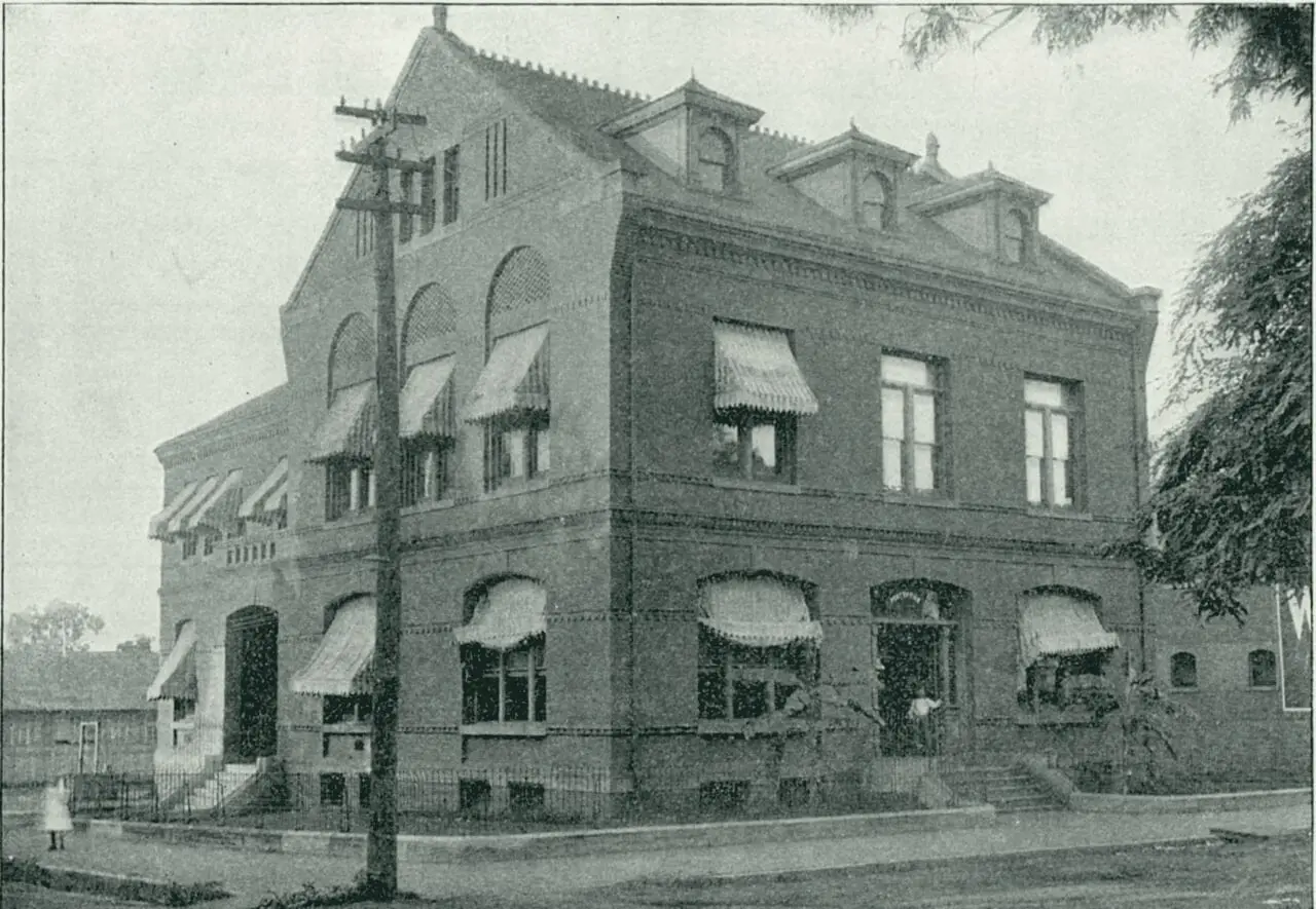
Tyler’s first public library, the Carnegie Library at 125 South College Avenue, is built with a $15,000 Carnegie grant and opens with 12,000 books. It is the 15th of 34 Carnegie libraries in Texas, designed by Patton & Miller of Chicago.
1934
It doubles in size with a Public Works Administration grant. The Smith County Historical Society says it was the first building in downtown Tyler with running water.
1905
The St. Louis Southwestern Railway, known as the Cotton Belt, builds the brick passenger depot on the north side of Oakwood Street, after the Texas Railroad Commission orders it to replace its 1880s frame depot at the southwest corner of Oakwood (then Common) Street and Fannin Avenue.
Wikipedia: Cotton Belt Depot Museum; Handbook of Texas; Wikipedia: National Register of Historic Places listings in Smith County, Texas; 1 more
For a few years
The depot is shared with the International and Great Northern, which later builds its own depot on North Fannin Avenue between Ferguson and Locust streets.
Before 1900
Across Oakwood Street lies the Levee, a rail business district named for a levee the Cotton Belt built north of its tracks, with hotels, restaurants and stores serving trainmen and travelers. The Tyler MPS says none of the buildings it names survive.
1910
The Cotton Belt spends $200,000 to more than double its Tyler shops, just northeast of the square.
1923 to 1935
The Cotton Belt employs 1,543 people in Tyler in 1923, with a $2.29 million payroll; 1,055 in 1927; 711 in 1935.
For 50 years
The depot has separate waiting rooms for white and Black passengers.
April 22, 1956
The last Cotton Belt passenger train passes through Tyler, ending just over 83 years of direct passenger rail service.
1986 or 1988
After years of freight and storage, the railroad gives the depot to the City of Tyler: in 1986, by the downtown nomination; in 1988, by other sources.
National Register nomination; Wikipedia; Handbook of Texas; 1 more
August 8, 2001
It is listed on the National Register of Historic Places.
Wikipedia: Cotton Belt Depot Museum; Handbook of Texas; Wikipedia: National Register of Historic Places listings in Smith County, Texas
2003
It reopens after a major renovation.
Wikipedia: Cotton Belt Depot Museum; Handbook of Texas; Wikipedia: National Register of Historic Places listings in Smith County, Texas
Today
Tyler Transit uses the old waiting area, and the Cotton Belt Depot Museum fills the former baggage area, centered on Clyde Bragg’s model-train collection.
Wikipedia: Cotton Belt Depot Museum; Handbook of Texas; Wikipedia: National Register of Historic Places listings in Smith County, Texas
1906
Rudolph Bergfeld sets aside the land for Bergfeld Park in a plat.
Tyler Morning Telegraph, September 7, 2025; Tyler Parks and Recreation; Tyler Texas Online
1909
He deeds it to the city, on condition that park work begin within six months.
Tyler Morning Telegraph, September 7, 2025; Tyler Parks and Recreation; Tyler Texas Online
After the deadline
When the park-work deadline has passed, Bergfeld offers to sell the land for $4,000. Our sources do not date the offer.
Tyler Morning Telegraph, September 7, 2025; Tyler Parks and Recreation; Tyler Texas Online
June 21, 1913
The city council approves the purchase.
Tyler Morning Telegraph, September 7, 2025; Tyler Parks and Recreation; Tyler Texas Online
1934 and 1936
The park, first called South Side Park, hosts the Texas Rose Festival’s coronation in 1934, and gains a stone amphitheater built with $10,000 given in 1936 by Sears, Roebuck president Robert Wood.
1888 to 1908
Residents form the Tyler Electric Light and Power Company in 1888. By 1908 the Tyler Gas Company, set up in 1907, lights the fixtures around the square, and the city engineer builds concrete sidewalks on North Spring Avenue.
1895 to 1912
A footnote in the downtown nomination counts three documented lynchings at the courthouse square between 1895 and 1912, none of which led to arrests or prosecution, and says newspapers of the period suggest there were others; the jail’s nomination says a district judge ordered many of the 1909 mob arrested.
1906 and 1907
According to the Tyler MPS, paving begins on July 2, 1906, with Thurber red brick at railroad crossings; the streets around the square follow in 1907 with brick from the Mineral Wells Brick Co. The Sanborn map dated September 1907 says ‘streets not paved.’ The Tyler Morning Telegraph, in 2015, put the first brick streets around 1912.
National Register Multiple Property Documentation Form; Library of Congress
1908
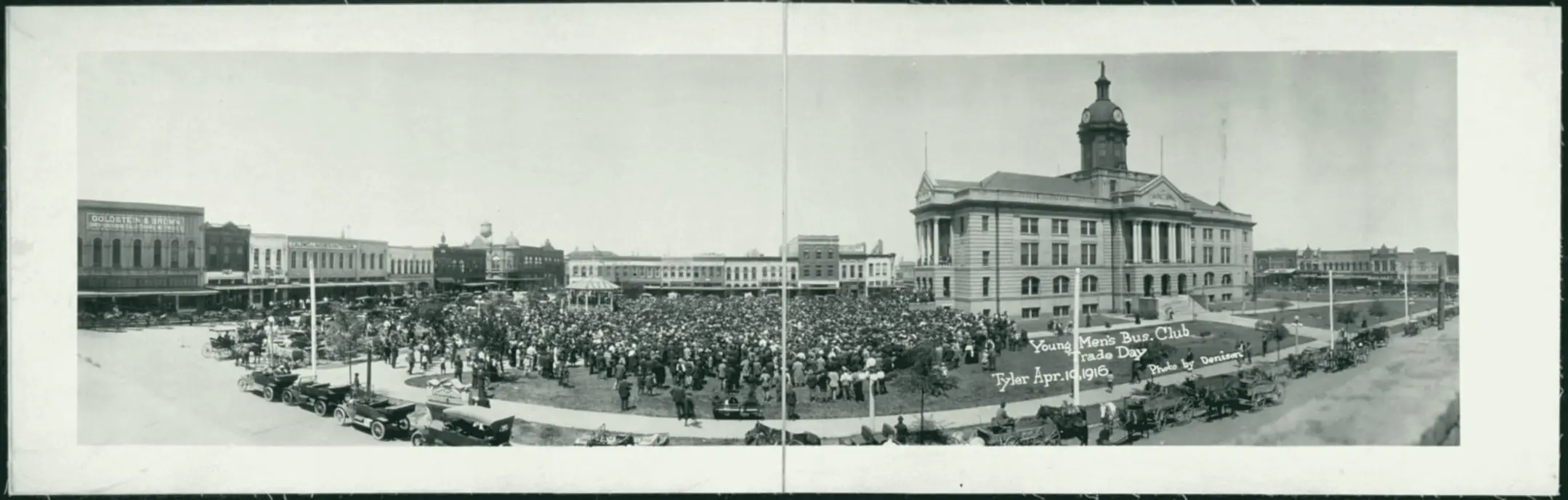
Work begins on a Classical Revival courthouse in the middle of the square. The Handbook of Texas dates the three-story courthouse to 1909.
1910
Smith County dedicates the courthouse commonly remembered in the county. It stood where Broadway now runs, and was in use for 45 years.
Smith County; Smith County Historical Society, 1909 Courthouse young trees (print); Smith County Historical Society, 1909 Smith County, Texas Courthouse (print)
February 1912
The Sanborn map of that month says on its first sheet: ‘About one mile of brick paved streets.’
September 1955
It is torn down, by the Smith County Historical Society’s date; the downtown nomination says it was razed before the new courthouse was built.
Smith County; Smith County Historical Society, 1909 Courthouse young trees (print); Smith County Historical Society, 1909 Smith County, Texas Courthouse (print)
1918
Emmett J. Scott High School opens as Tyler’s high school for Black students, named for Wiley College graduate Emmett J. Scott, a Black author, editor and civic leader. Students come from towns such as Chandler that have no high school for them.
By 1918
Tyler has three movie theaters: the Electric Palace and the Queen for white patrons and the Rapeeds Theater for African Americans. The Queen survives as the Arcadia on North Spring Avenue.
1931 and 1945
The Pollard nomination says Tyler’s city plans of 1931 and 1945 promoted segregation, recommending that services be withheld from Black neighborhoods near white ones and that Black schools and parks be placed away from white neighborhoods.
September 1956
The Texas attorney general seizes NAACP records and files suit in Tyler to bar the organization from doing business in Texas; the resulting injunction leaves the group nearly dormant.
Until 1964
Restrictive covenants on subdivisions and deeds confine Tyler’s African Americans to parts of central, northwest and southwest Tyler, according to the Tyler MPS, until the Civil Rights Act of 1964.
July 15, 1970
The federal government sues Tyler ISD to desegregate. That July Judge William Wayne Justice rejects the district’s neighborhood-school plan and orders its schools consolidated.
Associated Press via Fox News; Tarlton Law Library, William Wayne Justice exhibit
1970
Emmett J. Scott High closes under the integration order; its students and teachers are sent to John Tyler High School.
July 8, 1971
After Black and white students were listed separately on a cheerleader ballot at John Tyler High School, Judge Justice sets up a Bi-Racial Committee for Tyler ISD.
August 2016
U.S. District Judge Michael H. Schneider declares Tyler ISD integrated and dismisses the 1970 desegregation suit.
By 1910
Tyler’s African Americans have at least seven churches, including Bethlehem First Baptist on Front Street and Miles Chapel Methodist; by 1934 there are 16 Black congregations.
Early 1900s
Black entrepreneurs and professionals buy buildings and run businesses along the 200 block of East Erwin Street and an alley called Wall, an area remembered as Tyler’s ‘Black Wall Street.’
1920
Tyler’s population is about 77 percent white and 23 percent African American, according to the downtown nomination.
About 1930 to 1935
Five blocks northwest of the square, J.H. Herndon builds 11 nearly identical bungalows for African American occupants: the Short-Line district, which its nomination calls the only known surviving concentration of intact early- to mid-20th-century housing tied to Tyler’s African American community.
National Register nomination; THC Atlas, National Register listing
By 1934
Dr. Archie S. Senate, a Black physician born in Tyler in 1878, moves his practice to 210 East Erwin Street, a building that still carries a ‘SENATE’ plaque; Robert W. Porter’s People’s Cafe also occupies it.
1934
Henry Miller Morgan opens Tyler Barber College at 212 East Erwin Street, which the downtown nomination calls the first barber college for African Americans in the country. It grows into a chain with schools in Houston, Jackson, Mississippi, and Manhattan.
Today
Several Black-owned businesses, including a shine parlor, cafes and People’s Barber Shop at 216 and 218 East Erwin and the Wall Street Cafe at 224 Wall Street, stood where a parking lot now fills the northwest corner of East Erwin Street and North Fannin Avenue.
September 17, 1926
Tyler Junior College opens at Tyler High School with 93 students and nine faculty members.
Tyler Morning Telegraph, September 13, 2026; Handbook of Texas; Tyler Morning Telegraph, September 7, 2026
1924
The 1924 Tyler High School building at 331 South College Avenue, now Caldwell Arts Academy, stands in the downtown district with its 1936 Caldwell Gymnasium.
Fall 2026
In its 100th year, TJC enrolls a record 13,147 students, nearly 3% above its previous fall record.
October 3 or 5, 1930
Dad Joiner’s Daisy Bradford No. 3 in Rusk County comes in (October 3, by the Handbook of Texas; October 5, by the Tyler MPS) and discovers the East Texas oilfield, which the Handbook calls the largest and most prolific oil reservoir in the contiguous United States. The Tyler Chamber of Commerce campaigns at once for the oil business, citing the city’s location about 25 miles west on a good paved road.
Handbook of Texas; National Register Multiple Property Documentation Form
1930
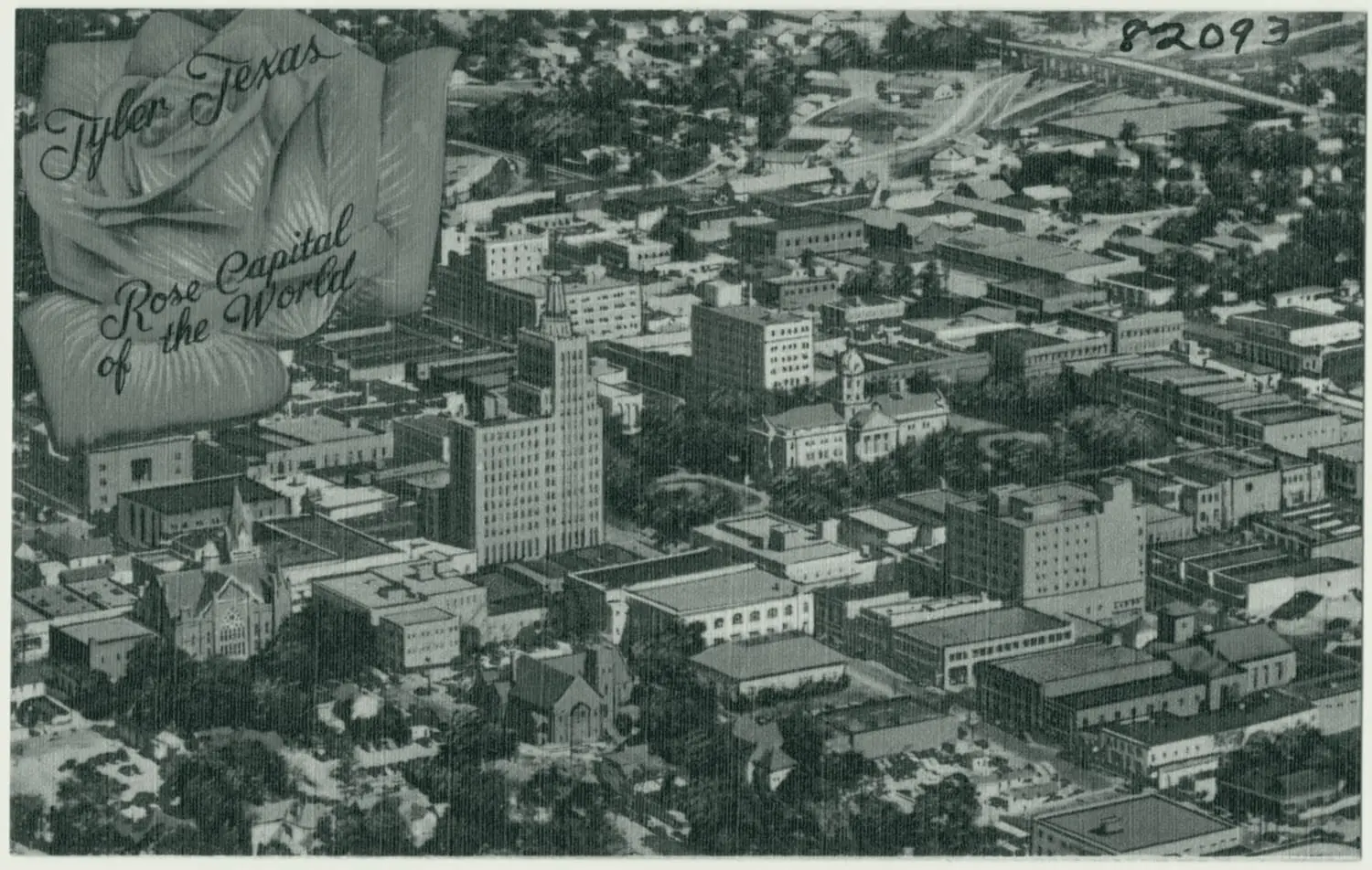
Tyler’s population is 17,113. The oil boom makes the town a regional center for the oil industry.
1930
Liberty Hall, a city venue downtown at 103 E. Erwin St., opens as the Liberty Theater.
1930 to 1931
Thirty-three companies open offices in Tyler, and almost all the larger independent operators set up land-leasing headquarters there. Building permit values pass $1 million by May 1931; by the year’s end the field has more than 3,600 wells.
National Register nomination, Short-Line Residential Historic District (2002); National Register nomination, Tyler Downtown Historic District (NRHP 100008283)
April 1932
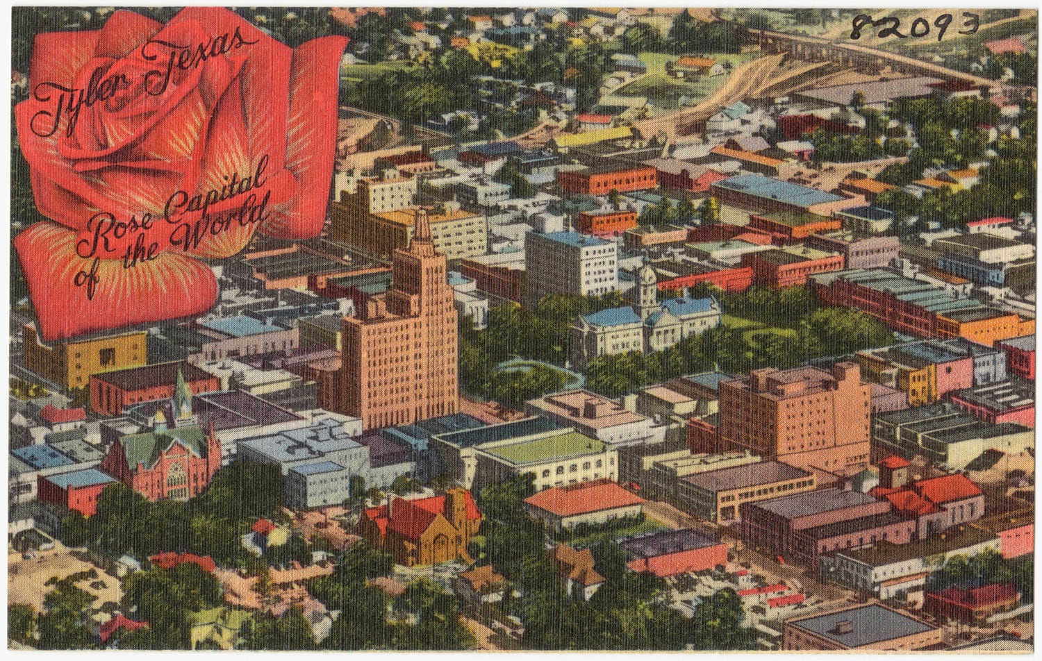
On the site of Goldstein and Brown’s store, partly destroyed by fire in 1930, the 15-story People’s National Bank Building is under construction at the northwest corner of North College Avenue and West Erwin Street, designed by Houston architect Alfred C. Finn. The downtown nomination calls it Tyler’s premier office building through the 1950s.
National Register nomination; THC Atlas, National Register listing
1932
The five-story Blackstone Hotel at North Broadway and East Locust Street, open since the early 1920s, adds nine stories for oil-boom newcomers. It was demolished in 1985.
National Register nomination, Tyler Downtown Historic District (NRHP 100008283); National Register nomination, Short-Line Residential Historic District (2002)
1930 to 1936
The school population rises from 4,261 students in 1930 to more than 6,000 in 1936, and assessed valuations from $17,477,254 in 1930 to $28,679,113 in 1935. Thirteen Art Deco buildings go up downtown in the boom years.
National Register Multiple Property Documentation Form; National Register nomination
March 18, 1937
Mother Frances Hospital opens, a day earlier than planned, to care for victims of the New London School explosion.
February 1938
Construction begins on the Art Deco Blackstone Building at 315 North Broadway. Its ground floor holds Tyler’s first union bus terminal; by 1945 fifteen oil-related businesses rent offices above.
1940
The census counts 28,279: growth of 65.2 percent in the 1930s. The Streamline Moderne Tyler Theater goes up at 110 West Erwin Street, by the downtown nomination’s inventory.
By April 1933
With $360,000 appropriated by Congress, the old federal building has been razed and construction of a new one is under way, by Ralph Sollitt and Sons of Chicago.
August 4, 1934
The Tyler U.S. Post Office and Courthouse, designed by Tyler architect Shirley Simons Sr. under Treasury supervising architect James A. Wetmore, is dedicated at the northeast corner of West Ferguson and North Bois D’Arc. Its address is 211 West Ferguson Street by the state’s Atlas, 221 by the downtown nomination’s inventory.
Until 1951
Federal judge Randolph Bryant, an oil and gas specialist, hears East Texas oil field cases in the courthouse.
1976
After the post office moves out, a Brutalist courthouse annex, approved by Congress in 1966, is finished for more than $2.8 million on the site of the Mayer & Schmidt department store.
1912
The city acquires the land that becomes the Rose Garden.
Visit Tyler; Tyler Morning Telegraph, September 6, 2025; Living New Deal
1937
The Tyler Park Board recommends six new parks, four for white residents and two ‘colored’ parks.
1938
The garden begins as a WPA park and rose garden project; the city puts its federal grant at $181,255. Lincoln Park, 2.5 acres at North Confederate Avenue and West Nutbush Street, is given for park use.
Visit Tyler; Tyler Morning Telegraph, September 6, 2025; Living New Deal; 1 more
1942
Rose Stadium, at 609 Fair Park Dr., opens. Tyler ISD owns it, and it seats 10,566.
KLTV, September 5, 2026; Tyler Morning Telegraph, September 6, 2025; TexasBob
1949
The city has six white playgrounds and three for Black children. That year Thomas R. Register, Rev. J.W. Presley and Dr. P.E. Madlock of the Tyler Negro Chamber of Commerce seek access to Tyler State Park and then file Register v. Sandefer; the park is fully integrated only after the Civil Rights Act of 1964.
National Register Multiple Property Documentation Form; Vicki Betts, "For the Citizens of East Texas"
1951
Tyler Civic Theatre, at 400 Rose Park Dr., opens what it calls the nation’s first building built specifically for theatre in the round.
1952
The Tyler Municipal Rose Garden officially opens with nearly 3,000 bushes donated by local nurseries.
Tyler Morning Telegraph, September 6, 2025; Garden Club of America; KTRE, January 25, 2021; 4 more
Today
The Rose Garden at 420 Rose Park Dr. covers 14 acres and is free and open dawn to dark every day, as listed when we researched it in September 2026.
Visit Tyler; Tyler Morning Telegraph, September 6, 2025; Living New Deal; 4 more
1876 to 1930s
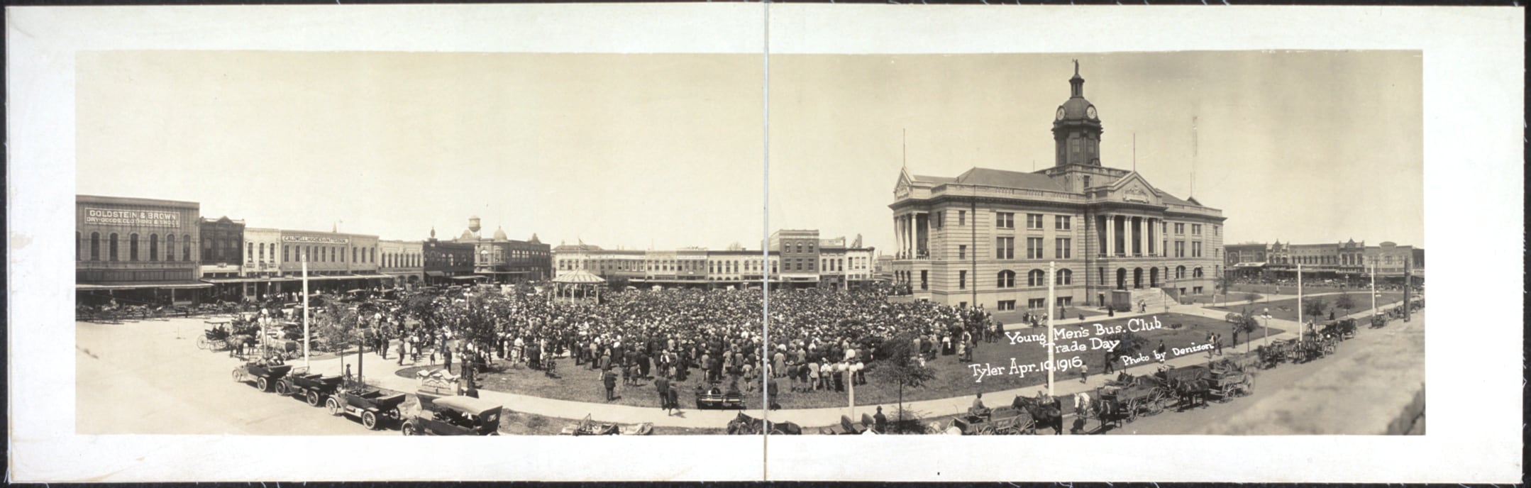
The East Texas District Fair Association acquires a 75-acre site south of First Street between Broadway, Donnybrook and Troup Highway in 1876. Rudolph Bergfeld buys the land in 1904, and his family subdivides it in the 1920s and 1930s.
After World War I
Air Corps veteran O.C. Palmer keeps a small biplane in South Tyler, east of Broadway about where Bergfeld Square is now, and takes passengers up for short flights.
Late 1940s
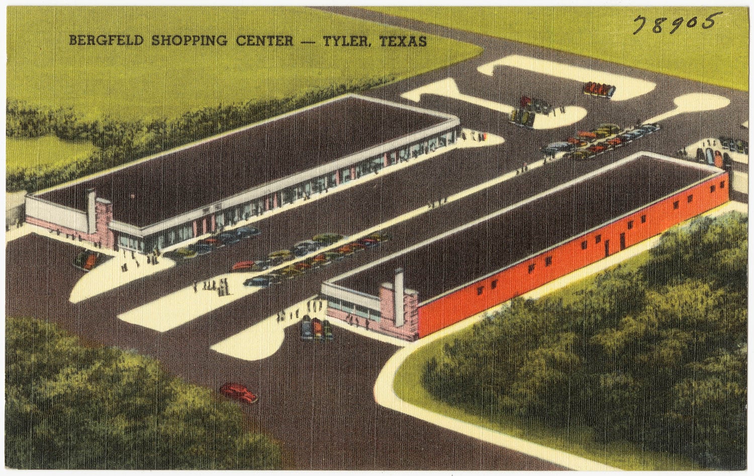
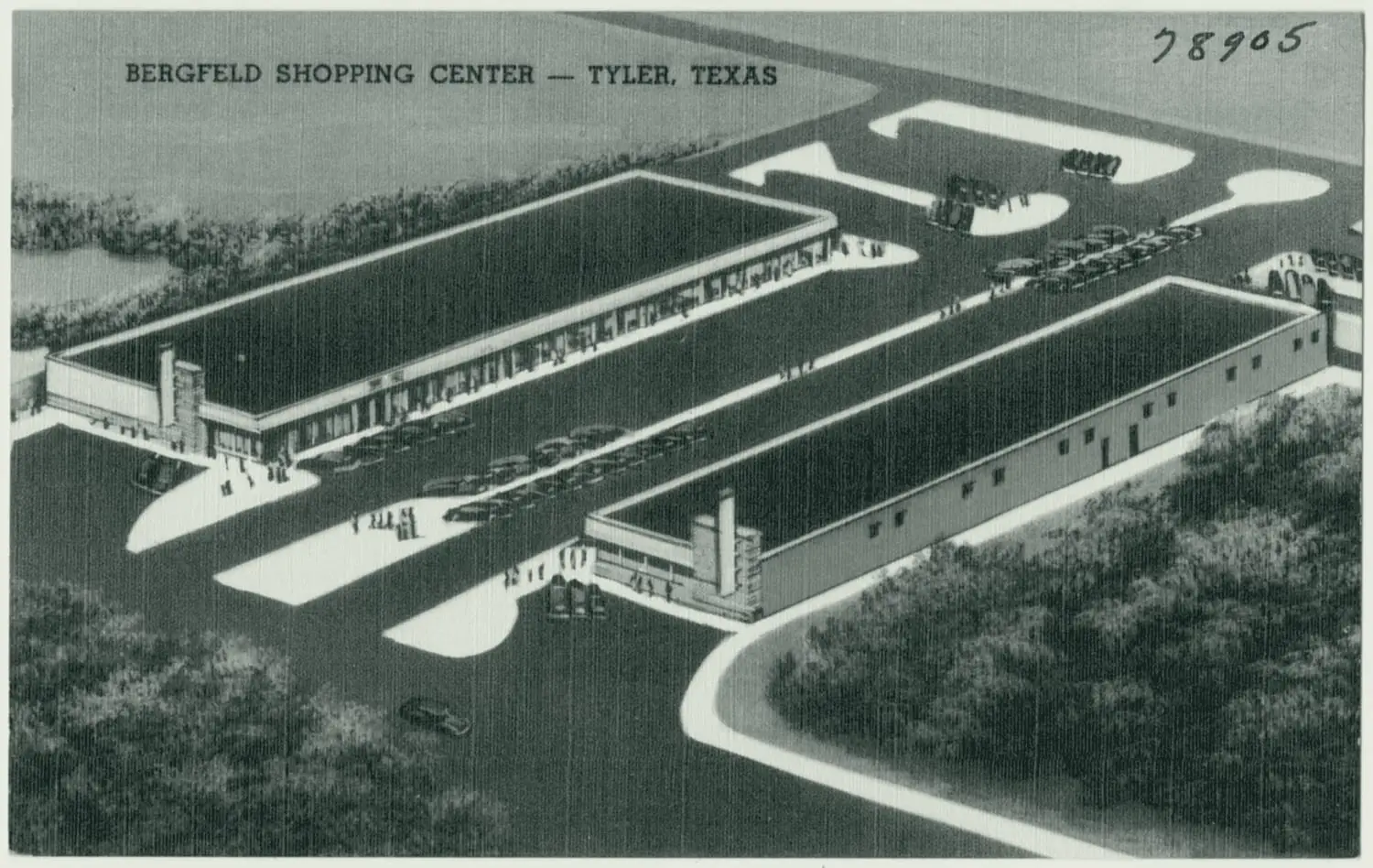
Bergfeld Square goes up on the old fairground, and Bergfeld Center opens in 1949. The city’s National Register documentation calls Bergfeld Square ‘Tyler’s first suburban shopping center’ in one passage and Bergfeld Center ‘one of Tyler’s first suburban shopping centers’ in another.
Tyler Morning Telegraph, September 28, 2014; Simon; National Register Multiple Property Documentation Form
April 1, 1975
Broadway Square Mall opens on South Broadway, when that part of town is considered ‘out in the country’.
May 1953
In a close election, Smith County voters approve a $1.5 million courthouse bond. Arthur E. Thomas of Dallas wins the architect contract and Rambo Construction of Fort Worth the building contract.
Mid-1950s
The county replaces the 1909 courthouse, extends Broadway through the split square, keeps the western half as a park and puts the new courthouse at the center of the eastern half.
1955
The six-story Smith County Courthouse is dedicated (the Handbook of Texas says it was built in 1954), to house two district courts, two justice of the peace courts, the jail and county offices. The $1.2 million building has twice the 1909 courthouse’s space.
September 1955
The old courthouse is torn down, by the Smith County Historical Society’s date.
Smith County; Smith County Historical Society, 1909 Courthouse young trees (print); Smith County Historical Society, 1909 Smith County, Texas Courthouse (print)
1965 and 1966
The county turns the western half of the square into a concrete plaza designed by Tyler architect Shirley Simons Jr., with a 70-by-20-foot lighted fountain; in 1966 the city announces it will be renamed T.B. Butler Fountain Plaza.
October 30, 1957
TxDOT designates Loop 323, the roughly 19.7-mile state loop around Tyler, from what had been FM 1803.
Late 1950s
East Southeast Loop 323, built in the 1950s, opens land along its route to new subdivisions. A ‘distributor’ loop to carry traffic around downtown had been a major recommendation of the city plans.
Early 1950s
By the early 1950s Tyler has issued more than $6 million in building permits, mostly in new subdivisions beyond its prewar neighborhoods, platted near highways on the southwest, west, northwest and southeast edges of town.
1955
National Homes, which the Pollard nomination calls the largest prefabricated home company in the country, opens a plant in north Tyler; about 540 of its houses go up in Tyler and Smith County between 1955 and 1975.
1960
Of Tyler’s 51,230 residents, 10,893 live in areas annexed since 1950. The city’s 1950 area has gained only 1,369 people.
1960s
Most of the land Tyler annexes lies to the south, stretching the city. In the 1960s it annexes stretches of highways 69 and 271, which give the city limits their bug-shaped outline.
1940 to 1980
Tyler adds roughly 28 square miles, mostly along its southern and western edges, according to the Pollard nomination citing The Tyler Loop.
1990
Tyler covers 39.7 square miles of land, with 1,900.5 people per square mile.
2011 and 2012
Tyler annexes Tyler Pounds Regional Airport in 2011 and the UT Health Science Center the next year.
1971
The Tyler Museum of Art opens, through the efforts of the Junior League of Tyler. It sits on the Tyler Junior College campus at 1300 S. Mahon.
January 1973
Tyler State College opens upper-division classes in the abandoned O.M. Roberts Junior High School.
1975
As Texas Eastern University, the college moves to a 200-acre wooded tract in southeast Tyler bordered by Old Omen Road, Patriot Avenue and University Boulevard.
June 2, 1979
It joins the UT System after Gov. Bill Clements signs Senate Bill 906.
Fall 2026
UT Tyler’s preliminary fall 2026 enrollment is a record 11,701 students, and its main campus in southeast Tyler covers more than 260 acres.
Handbook of Texas; Gilmer Mirror, September 14, 2026; UT Tyler
1893
Hispanic families appear in Tyler city directories as early as 1893, when Domingo Garcia, listed as Mexican, runs a restaurant at Broadway and Erwin.
1920s
More Spanish surnames appear in the directories, most of them living just south of the Cotton Belt tracks and east of the Levee.
September 6, 1977
At the start of the 1977-78 school year Tyler ISD begins charging $1,000 for each undocumented child. MALDEF lawyers file a class action against it, and superintendent James Plyler’s name goes on the case.
1977
The Handbook of Texas says MALDEF chose Tyler for a progressive judge (William Wayne Justice), sympathetic clients in families whose children held different immigration status, and a rural area where the media glare would be less.
September 14, 1978
Judge Justice strikes down the state law as applied to Tyler ISD.
June 15, 1982
The U.S. Supreme Court affirms the children’s right to attend, 5-4, in Plyler v. Doe.
2000 and 2010
The census counts 13,234 Hispanic or Latino residents in Tyler in 2000, about 16 percent, and 20,511 in 2010, about 21 percent.
U.S. Census Bureau, 2000 Census SF1 table P004 (Hispanic or Latino), Tyler city; U.S. Census Bureau, 2010 Census SF1 table P4 (Hispanic or Latino origin), Tyler city
2014-15
Tyler ISD has more than 18,000 students, about 45 percent Hispanic, nearly 30 percent Black and nearly 22 percent white.
August 20, 1999
Charnwood is listed: about 59.54 acres on Charnwood Hill, half a mile south of the original square, with a period of significance of about 1870 to 1950.
THC Atlas, National Register listing: Charnwood Residential Historic District; THC Atlas, National Register listing: Donnybrook Duplex Residential Historic District; THC Atlas, National Register listing: East Ferguson Street Residential Historic District; 6 more
June 14, 2002
Donnybrook Duplex (18 one-story duplexes of 1947 and 1948) and East Ferguson Street (six nearly identical Craftsman bungalows built between 1926 and 1930 as rental housing) are listed.
THC Atlas, National Register listing: Charnwood Residential Historic District; THC Atlas, National Register listing: Donnybrook Duplex Residential Historic District; THC Atlas, National Register listing: East Ferguson Street Residential Historic District; 7 more
August 22, 2002
Short-Line is listed: 11 bungalows built for African American occupants about 1930 to 1935, five blocks northwest of the square.
THC Atlas, National Register listing: Charnwood Residential Historic District; THC Atlas, National Register listing: Donnybrook Duplex Residential Historic District; THC Atlas, National Register listing: East Ferguson Street Residential Historic District; 6 more
June 23, 2003
Azalea is listed: 76 city blocks and 36 platted subdivisions on about 458.9 acres one to two miles south of the square.
THC Atlas, National Register listing: Charnwood Residential Historic District; THC Atlas, National Register listing: Donnybrook Duplex Residential Historic District; THC Atlas, National Register listing: East Ferguson Street Residential Historic District; 6 more
April 28, 2004
Brick Streets is listed: about 132.6 acres in 29 blocks and 16 subdivisions.
THC Atlas, National Register listing: Charnwood Residential Historic District; THC Atlas, National Register listing: Donnybrook Duplex Residential Historic District; THC Atlas, National Register listing: East Ferguson Street Residential Historic District; 6 more
October 24, 2022
The Tyler Downtown Historic District is listed: about 71.6 acres and about 19 blocks between West Front Street, Border Avenue, the Cotton Belt tracks and Fannin Avenue. Of its 134 resources, 96 contribute.
THC Atlas, National Register listing: Charnwood Residential Historic District; THC Atlas, National Register listing: Donnybrook Duplex Residential Historic District; THC Atlas, National Register listing: East Ferguson Street Residential Historic District; 6 more
January 29, 2026
Pollard is listed: about 580 acres and more than 85 blocks about three miles southeast of downtown, named for Tomas and Edna Pollard, whose family owned most of its original acreage. Its period of significance is 1947 to 1974.
THC Atlas, National Register listing: Charnwood Residential Historic District; THC Atlas, National Register listing: Donnybrook Duplex Residential Historic District; THC Atlas, National Register listing: East Ferguson Street Residential Historic District; 6 more
2000 and 2010
The census counts 83,650 people in 2000 and 96,900 in 2010. Of them, 22,275 are Black or African American alone in 2000, about 27 percent, and 23,986 in 2010, about 25 percent.
U.S. Census Bureau, 2000 Census SF1 table P001 (data.census.gov API), Tyler city, Texas; Handbook of Texas; U.S. Census Bureau, 2010 Census SF1 table P1 (data.census.gov API), Tyler city, Texas; 2 more
2020
The 2020 census counts 105,995 residents in Tyler.
U.S. Census Bureau: sub-est2025.csv; Handbook of Texas; U.S. Census Bureau: 2024_gaz_place_48.txt; 2 more
July 1, 2025
The Census Bureau estimates 113,723 residents, up about 7.4% from its April 2020 estimates base of 105,867.
U.S. Census Bureau: sub-est2025.csv; Handbook of Texas; U.S. Census Bureau: 2024_gaz_place_48.txt; 2 more
July 1, 2025
The Tyler metro area is Smith County alone, with an estimated 252,549 people.
U.S. Census Bureau: cbsa-est2025-alldata.csv; U.S. Census Bureau: sub-est2025.csv; Handbook of Texas; 1 more
July 2020 to July 2025
Smith County grows mainly because people move in from elsewhere in the U.S.: Census estimates show net domestic migration added about 13,980 people, compared with about 2,340 from international migration and about 1,845 from births minus deaths.
November 8, 2022
A $179 million bond for a new Smith County courthouse downtown passes with 53.73% of the vote. The county plans to move in and demolish the current courthouse by fall 2027.
August 15, 2024
Smith County breaks ground on its new courthouse, after demolition of buildings on East Erwin Street and Fannin and Spring avenues began that July. It is expected to open at the end of 2026.
Smith County; Tyler Morning Telegraph, June 10, 2026; Tyler Morning Telegraph, September 7, 2026; 2 more
November 12, 2024
The free, five-story, 543-space Smith County Parking Garage opens at 210 East Ferguson Street, paid for with $19 million of the courthouse bond.
July 8, 2025
The $25.6 million Downtown Improvement Project, built by The Fain Group of Fort Worth, has two phases: Phase I rebuilds Erwin Street, Broadway Avenue, Ferguson Street and College Avenue with water and sewer lines; Phase II builds new green space on the west side of the square.
September 2025
The Downtown Improvement Project begins. It converts the streets around the square to two-way traffic and rebuilds the square with green space and restrooms.
Tyler Morning Telegraph, April 29, 2026; Tyler Morning Telegraph, September 7, 2026; KLTV, March 2, 2026
September 2025
Crews take up every brick on College Avenue between Ferguson and Erwin streets, palletize them and store them.
March 2, 2026
Bricks saved from the streets go back down on College Avenue in front of Plaza Tower.
KLTV, March 2, 2026; KLTV, March 18, 2026; Tyler Morning Telegraph, March 18, 2026
May 2026
Phase I, covering Erwin Street, Broadway Avenue, Ferguson Street and College Avenue, finishes.
Tyler Morning Telegraph, April 29, 2026; Tyler Morning Telegraph, September 7, 2026; KLTV, March 2, 2026
August 2026
The city’s engineering director says underground work on College Avenue and Ferguson Street is largely done, that roadway work will move next to Broadway starting near Locust Street, and that two-way traffic will return to the west side of the square.
Week of September 7, 2026
North Broadway work begins, after Labor Day.
Tyler Morning Telegraph, April 29, 2026; Tyler Morning Telegraph, September 7, 2026; KLTV, March 2, 2026
By May 2027 · expected
Green space on the square is due.
Tyler Morning Telegraph, April 29, 2026; Tyler Morning Telegraph, September 7, 2026; KLTV, March 2, 2026
From November 2027 · expected
Roundabouts on South Broadway are to start.
Tyler Morning Telegraph, April 29, 2026; Tyler Morning Telegraph, September 7, 2026; KLTV, March 2, 2026
By April 2028 · expected
The whole project is now expected to finish, by news reports; the state’s registration of the project lists November 30, 2028. Completion dates have moved before.
Tyler Morning Telegraph, June 10, 2026; Tyler Morning Telegraph, September 7, 2026; Tyler Morning Telegraph, April 29, 2026; 2 more
September 1, 1928
Wood T. Brookshire opens a 2,500-square-foot grocery on the downtown Tyler courthouse square. It is the start of Brookshire Grocery Co.
Brookshire's; Tyler Economic Development Council; Handbook of Texas
July 9, 2026
Brookshire’s breaks ground on a $17 million, roughly 58,467-square-foot store at 3765 Earl Campbell Parkway in west Tyler, with a full-service Stanley’s. It is expected to be complete by fall 2027.
Fall 2026
TJC enrolls a record 13,147 students, in its 100th year.
Fall 2026
UT Tyler’s preliminary enrollment is a record 11,701 students.
Handbook of Texas; Gilmer Mirror, September 14, 2026; UT Tyler
2026
New retail is planned on South Broadway near The Village at Cumberland Park, including a BJ’s Wholesale Club at 8667 S. Broadway and a Dave & Buster’s at 8930 S. Broadway. Neither had announced an opening date as of September 29, 2026.
Tyler Morning Telegraph, May 13, 2026; KLTV, August 21, 2026; Mix 93.1
The center of the schematic. The sources say 'a central square'; we center it on the city square downtown, which they do not name.
Hollow pin: where it stands today.
On North Palace Avenue at West Oakwood Street; the Tyler MPS calls it the oldest cemetery in Tyler.
Filled pin: the place itself.
National Register Multiple Property Documentation Form
Built as 'Bonnie Castle', 624 N. Broadway.
Filled pin: the place itself.
Tyler Morning Telegraph, September 6, 2025; Tyler Morning Telegraph, March 20, 2026
The plant’s own site is not in our sources; the pin is the 1969 marker in Bergfeld Park that stands near it.
Hollow pin: where it stands today. The dotted ring means right to the block, not the building.
THC Atlas, historical marker 7763
A Civil War prisoner-of-war camp, four miles northeast of town.
Filled pin: the place itself.
Handbook of Texas: Tyler, TX; Handbook of Texas: Camp Ford; National Register of Historic Places nomination; 1 more
On East Erwin Street just east of the square; the county’s jail until 1916.
Filled pin: the place itself.
National Register nomination; THC Atlas, National Register listing
408 N. Border Ave.; begun in 1888 as a wooden church, bricked in the 1920s.
Filled pin: the place itself. The dotted ring means right to the block, not the building.
National Register Multiple Property Documentation Form; THC Atlas, National Register listing; National Register nomination
Built in 1890 at the southwest corner of West Erwin Street and South Bois D’Arc Avenue.
Filled pin: the place itself.
National Register nomination; THC Atlas, National Register listing
Founded in 1894 north of the city limits; the campus at North Grand Avenue and Barrett Street.
Filled pin: the place itself.
Handbook of Texas; National Register nomination, Martin Hall at Texas College (2005); National Register nomination, D. R. Glass Library at Texas College (2007)
Tyler’s first public library, 125 S. College Ave.; the Smith County Historical Society since the mid-1980s.
Filled pin: the place itself.
Built by the St. Louis Southwestern Railway, 210 E. Oakwood St.
Filled pin: the place itself. The dotted ring means right to the block, not the building.
Wikipedia: Cotton Belt Depot Museum; Handbook of Texas; Wikipedia: National Register of Historic Places listings in Smith County, Texas
Platted in 1906, deeded to the city in 1909, bought in 1913.
Filled pin: the place itself.
Tyler Morning Telegraph, September 7, 2025; Tyler Parks and Recreation; Tyler Texas Online
It stood in the middle of the square, where Broadway now runs; torn down in the 1950s.
Filled pin: the place itself. The dotted ring means right to the block, not the building.
Smith County; Smith County Historical Society, 1909 Courthouse young trees (print); Smith County Historical Society, 1909 Smith County, Texas Courthouse (print); 2 more
The 200 block of East Erwin Street; 210 still carries a ‘SENATE’ plaque.
Filled pin: the place itself. The dotted ring means right to the block, not the building.
Opened in 1926 at Tyler High School; the pin is the campus on South Baxter Avenue today.
Hollow pin: where it stands today.
Tyler Morning Telegraph, September 13, 2026; Handbook of Texas; Tyler Morning Telegraph, September 7, 2026
Opened as the Liberty Theater in 1930, 103 E. Erwin St.
Filled pin: the place itself. The dotted ring means right to the block, not the building.
City of Tyler; KLTV, May 31, 2025; UT Tyler press release
Fifteen stories, at the northwest corner of North College Avenue and West Erwin Street.
Filled pin: the place itself. The dotted ring means right to the block, not the building.
Dedicated in 1934 at the northeast corner of West Ferguson Street and North Bois D’Arc Avenue.
Filled pin: the place itself. The dotted ring means right to the block, not the building.
Art Deco, 315 N. Broadway; begun in February 1938.
Filled pin: the place itself. The dotted ring means right to the block, not the building.
A 1938 WPA project, officially opened in 1952.
Filled pin: the place itself.
Visit Tyler; Tyler Morning Telegraph, September 6, 2025; Living New Deal; 4 more
2.5 acres at North Confederate Avenue and West Nutbush Street, one of two ‘colored’ parks.
Filled pin: the place itself.
National Register Multiple Property Documentation Form
Opened in 1942, 609 Fair Park Dr.
Filled pin: the place itself.
KLTV, September 5, 2026; Tyler Morning Telegraph, September 6, 2025; TexasBob
Opened what it calls the nation’s first theatre-in-the-round building in 1951; the pin is the theatre at 400 Rose Park Dr. today.
Hollow pin: where it stands today.
Six stories, dedicated in 1955 on the eastern half of the split square, 100 N. Broadway.
Filled pin: the place itself.
Smith County; National Register nomination
Founded in 1971 as Tyler State College; the pin is the main campus today.
Hollow pin: where it stands today.
Opened in 1971; it sits on the TJC campus at 1300 S. Mahon.
Hollow pin: where it stands today.
Opened April 1, 1975, when that part of town was 'out in the country'.
Filled pin: the place itself.
1846–1872
The plat around a square, the first courthouses, a house on Broadway, and the Civil War’s camp and ordnance plant.
1847 to –1850
A 100-acre site bought for $150 and laid out as a town.
1852 to –1858
Log courthouses, then one of brick in the middle of the square, in use until 1908.
1859
A house built in 1859; the city took ownership in 1940.
1863 to –1865
Tyler in the Civil War: an ordnance plant and a prison camp.
1873–1905
A branch line and the Tyler Tap, the jail on Erwin Street, two churches that still stand, Texas College, the Carnegie Library, the depot.
Under the plate: the Sanborn maps of 1885, 1889, 1893, 1898 and 1902. Open 1885 on the ruler
1873 to –1880
A branch line from Troup, then the town’s own Tyler Tap, the start of the Cotton Belt.
1881 to –1916
Built between 1880 and 1881 just east of the square; the county’s jail until 1916.
1888 to –1891
A wooden church of 1888 or 1889 on North Border Avenue, bricked about 1920.
1890 to –1935
A brick church of 1890 that the downtown nomination calls its district’s oldest building.
1894 to –1936
Founded in 1894 north of the city limits; annexed to the city in 1936.
1904 to –1934
Tyler’s first public library, built by 1904 with a $15,000 Carnegie grant.
1905
The depot at 210 E. Oakwood St.: built by the railroad in 1905, given to the city in 1986 or 1988, reopened in 2003.
1906–1929
A park on Bergfeld land, the courthouse in the middle of the square, a high school for Black students, Black Wall Street, a junior college.
Under the plate: the Sanborn maps of 1907, 1912, 1919 and 1928. Open 1907 on the ruler
1906 to –1913
A plat, a deed with a deadline, and a purchase.
1910 to –1955
Dedicated in 1910 in the middle of the square, where Broadway now runs; torn down in the 1950s.
1918 to –1970
Tyler’s high school for Black students, from 1918 until it closed under the integration order in 1970.
1920 to –1934
Black-owned businesses on the 200 block of East Erwin Street and an alley called Wall.
1926
Ninety-three students and nine faculty, at Tyler High School.
1930–1945
A discovery in Rusk County, towers downtown, a new federal building, and parks laid out white and ‘colored’.
Under the plate: the Sanborn map of 1938. Open 1938 on the ruler
1930 to –1941
A discovery in Rusk County, and towers downtown: Tyler’s count of people climbs from 17,113 to 28,279.
65.2% growth in Tyler’s population in the 1930s, to 28,279 by the 1940 census
1934 to –1976
A federal building of 1934 on the site of the one it replaced, at West Ferguson and North Bois D’Arc.
1938 to –1952
A WPA garden, a stadium and a theater on the west side, and one of two ‘colored’ parks.
1946–1976
Shopping centers, Broadway run through the square, Loop 323, annexation, a state college.
Under the plate: the USGS map of 1948. Open 1948 on the ruler
1949 to –1975
Bergfeld Center on the old fairground in 1949, then a mall on South Broadway in 1975.
1955 to –1966
A new courthouse, Broadway run through the middle of the square, and a plaza on its western half.
1957
A state loop around Tyler, designated in 1957.
1960 to –1990
Of 51,230 residents in 1960, 10,893 lived in areas annexed since 1950.
10,893 of 51,230 residents in 1960 lived in areas annexed since 1950
1971 to –1979
Tyler State College and the Tyler Museum of Art open the same year.
1977–2028
A Supreme Court case that began in Tyler, eight historic districts, the 2020 count, and the downtown being rebuilt now.
1977 to –1982
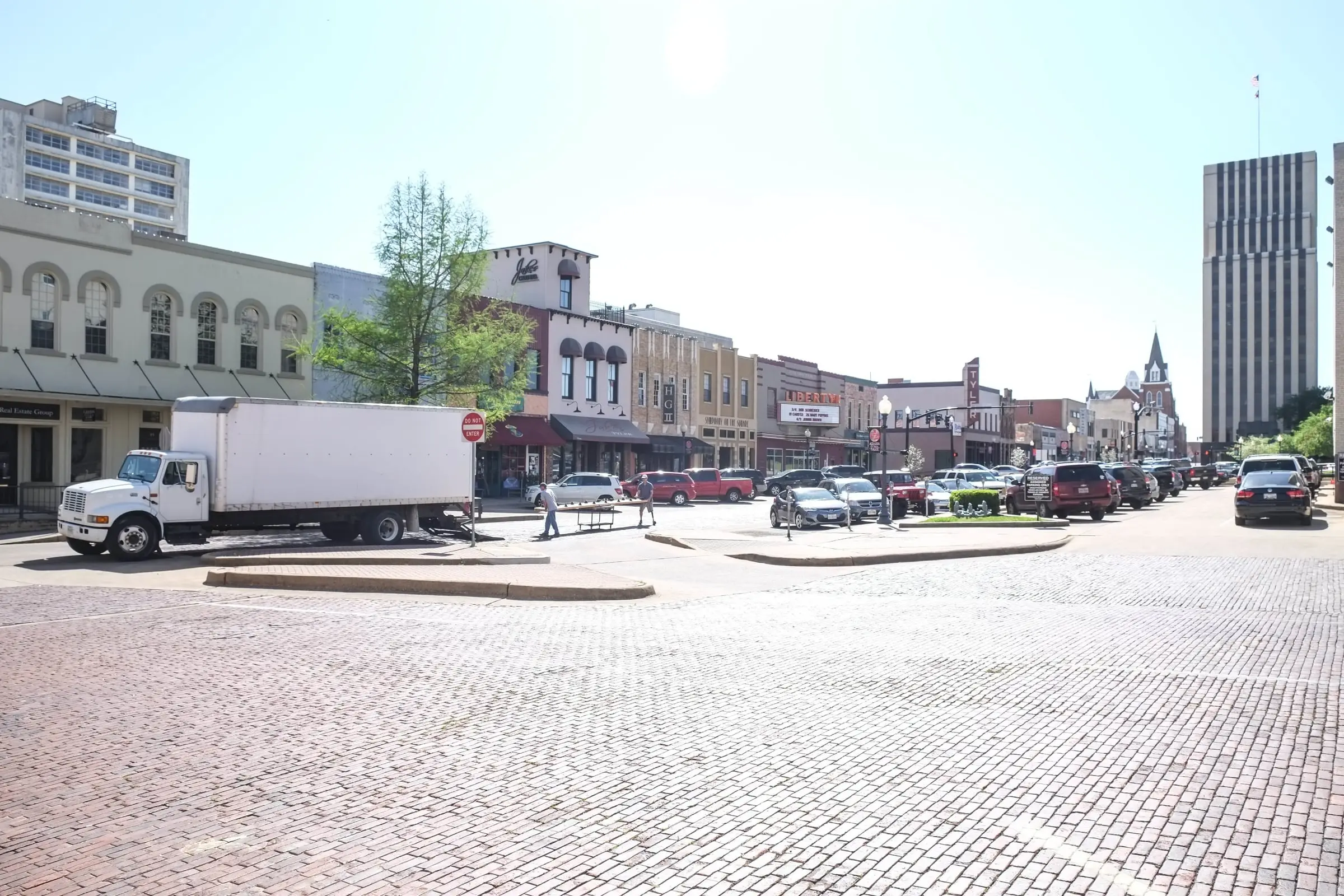
A tuition charge in Tyler’s schools, a class action filed in Tyler, and a Supreme Court decision in 1982.
1999 to –2026
Eight National Register historic districts, listed from 1999 to January 2026.
2020 to –2025
105,995 people in the 2020 census, and an estimate of 113,723 five years on.
113,723 residents, Census Bureau estimate, July 1, 2025
2025 to –2028
A $25.6 million city-county rebuild of downtown’s streets, utilities and square.
2026
The same names, side by side: a grocery on the square in 1928, a groundbreaking in 2026.